Hologram Lidar Scanning Technology for Advanced 3D Solutions
LiDAR scanning captures physical spaces, structures, and environments as precise three-dimensional point cloud data — creating accurate digital twins that serve as the foundation for experience design, spatial planning, and immersive content development.
Vision3D uses professional LiDAR scanning as an integral part of the experience design process — capturing existing spaces with millimetre accuracy to ensure that holographic installations, projection systems, and interactive environments are designed to fit perfectly within their intended physical contexts.
Beyond design support, LiDAR scan data creates valuable digital assets — accurate spatial models that can be used for virtual tours, architectural documentation, heritage preservation, and facility management long after the initial scanning is complete.
Digital twin creation and synchronisation architecture
Technology Overview
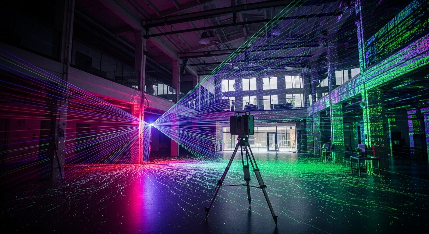
LiDAR scanning uses laser-based distance measurement to capture millions of spatial data points, creating highly accurate three-dimensional representations of physical environments.
Terrestrial Laser Scanning
Ground-based LiDAR scanners that capture interior and exterior environments with millimetre precision, generating dense point clouds from multiple scan positions.
Mobile LiDAR Systems
Handheld and backpack-mounted scanning systems that enable rapid capture of large spaces, corridors, and complex environments while in motion.
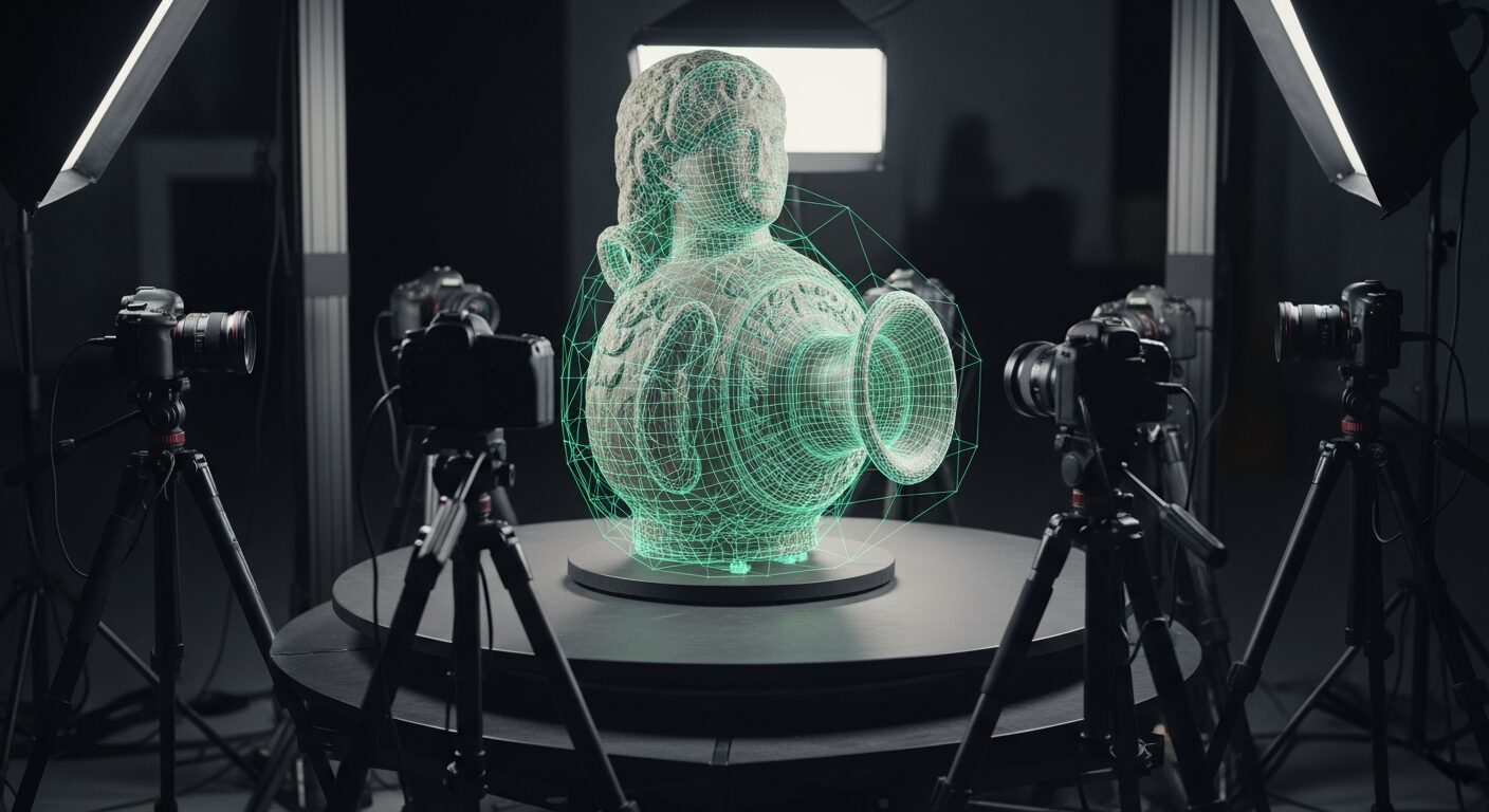
Point Cloud Processing
Advanced software pipelines that clean, align, and merge multiple scan datasets into unified, navigable 3D point cloud models.
BIM & CAD Integration
Export and integration capabilities that deliver LiDAR data in formats compatible with architectural modelling, engineering, and design software platforms.
Applications
Experience Design Site Survey
Capture existing spaces accurately before designing immersive installations, ensuring holographic displays and projection systems fit perfectly within the venue.
Heritage & Conservation Documentation
Create permanent digital records of heritage buildings, monuments, and cultural sites for preservation, research, and restoration planning.
Facility Digital Twins
Build accurate 3D digital twins of buildings and facilities for ongoing management, renovation planning, and operational optimization.
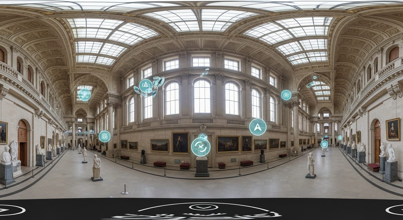
Virtual Tour Content Creation
Generate the spatial foundation for immersive virtual tours, enabling remote audiences to explore scanned environments in three dimensions.
Example Installations
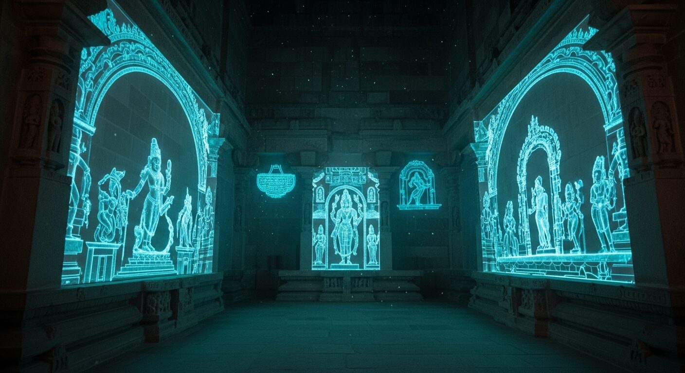
Heritage Temple Survey
Complete LiDAR scan of a 200-year-old temple complex, creating a millimetre-accurate digital twin for conservation planning and virtual access.
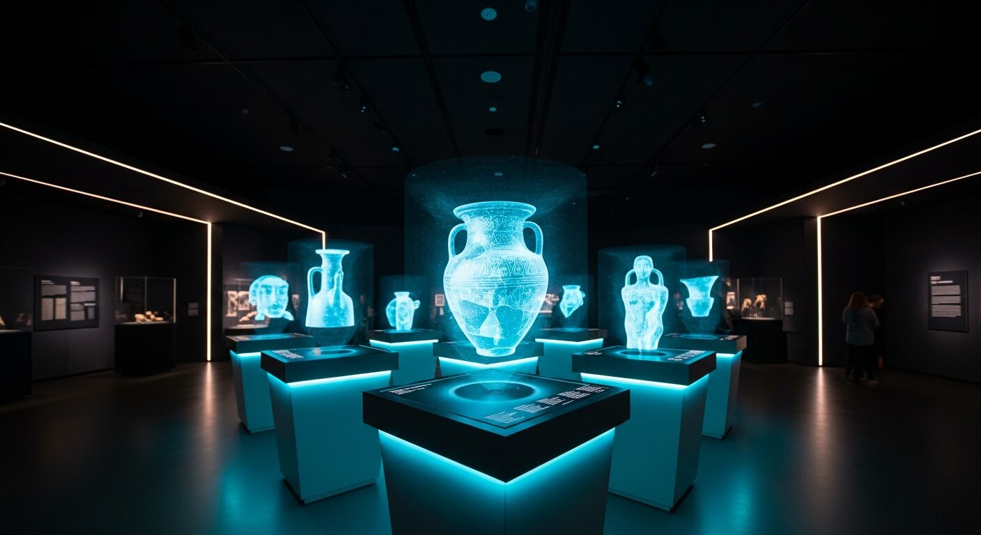
Exhibition Venue Mapping
Pre-installation LiDAR survey of gallery spaces enabling precise design of projection mapping, holographic displays, and interactive installations.
Campus Digital Twin
Multi-building LiDAR scanning programme creating comprehensive digital twins for facility management, wayfinding, and virtual campus tours.
Related Technologies
Related Solutions
Solutions that use this technology.
Learn More
In-depth articles about this technology.
Bring This Experience to Your Space
Tell us about your project and vision. We'll explore how hologram lidar scanning technology for advanced 3d solutions technology can transform your environment.